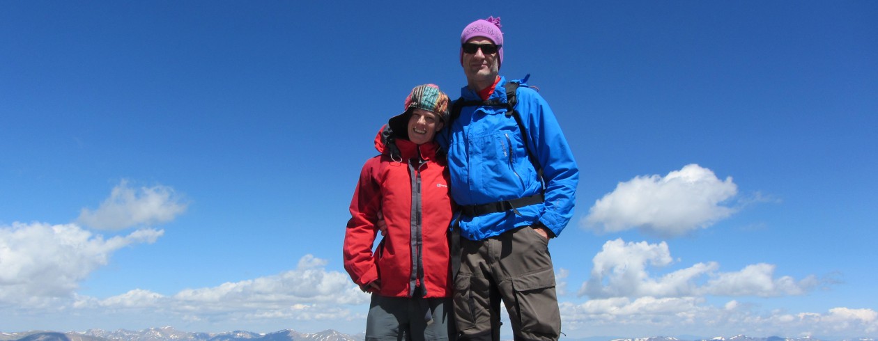
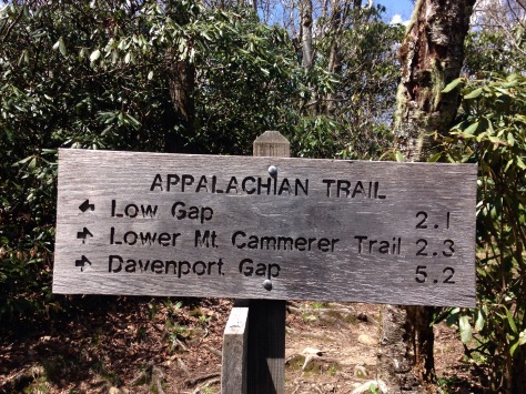
Made it to Damascus, Virginia after a 24 miles (38 km) hike yesterday, zero day nr 4 today. Totally we have done 469 (478) miles/ 765 km in 34 days.
Resuming what was most non-expected during the first month on the trail:
1) Rhododendron: we’ve seen 1000x more Rhododendron bushes than so far in our lives. Had no idea that the Southern Appalachians are that full of Rhododendron.
2) No trail magic: have’nt seen any trail magic for more than 3 weeks. Yesterday there was a sign which announced a box provided by a Baptiste church but inside there was only scrap and empty cans.
3) Ups and downs: was aware that it’s a lot of climbs and descents but reality is even harder. Long climbs are fine, this is a fair deal you prepare for, but all these 10-20 minor ups and downs every day are really hard.
4) Changing weather: snow, hail and icy rain on Roan Mt, sun and almost 30 C 3 days later.
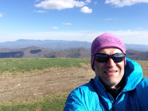
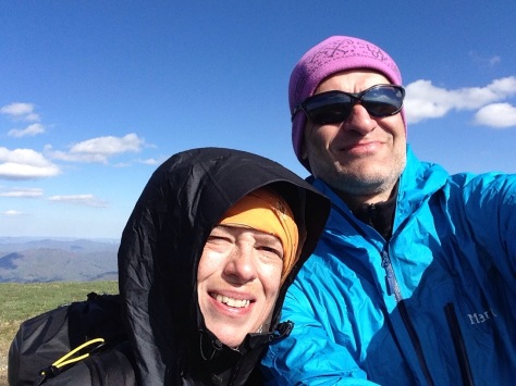
Mile 394 (403), km 649. Hiker hell and heaven within 3 days time. Started after our 3rd zero day in Erwin with sunny weather which in the afternoon turned to really harsh conditions. Heavy rainfall, several hail showers, icy wind and temperatures down to 0 (C). A very cold night at 1250m, the next day up to over 1900m including snow on Roan Mt. No idea to spend an even colder night on the highest shelter of the AT so we continued and got by chance a shuttle back to Erwin we had not hoped for. After a WARM motel night back to the trail with a section hiker couple. Then the best day so far on Hump Mt, great views, clear blue sky and a lot of sun!
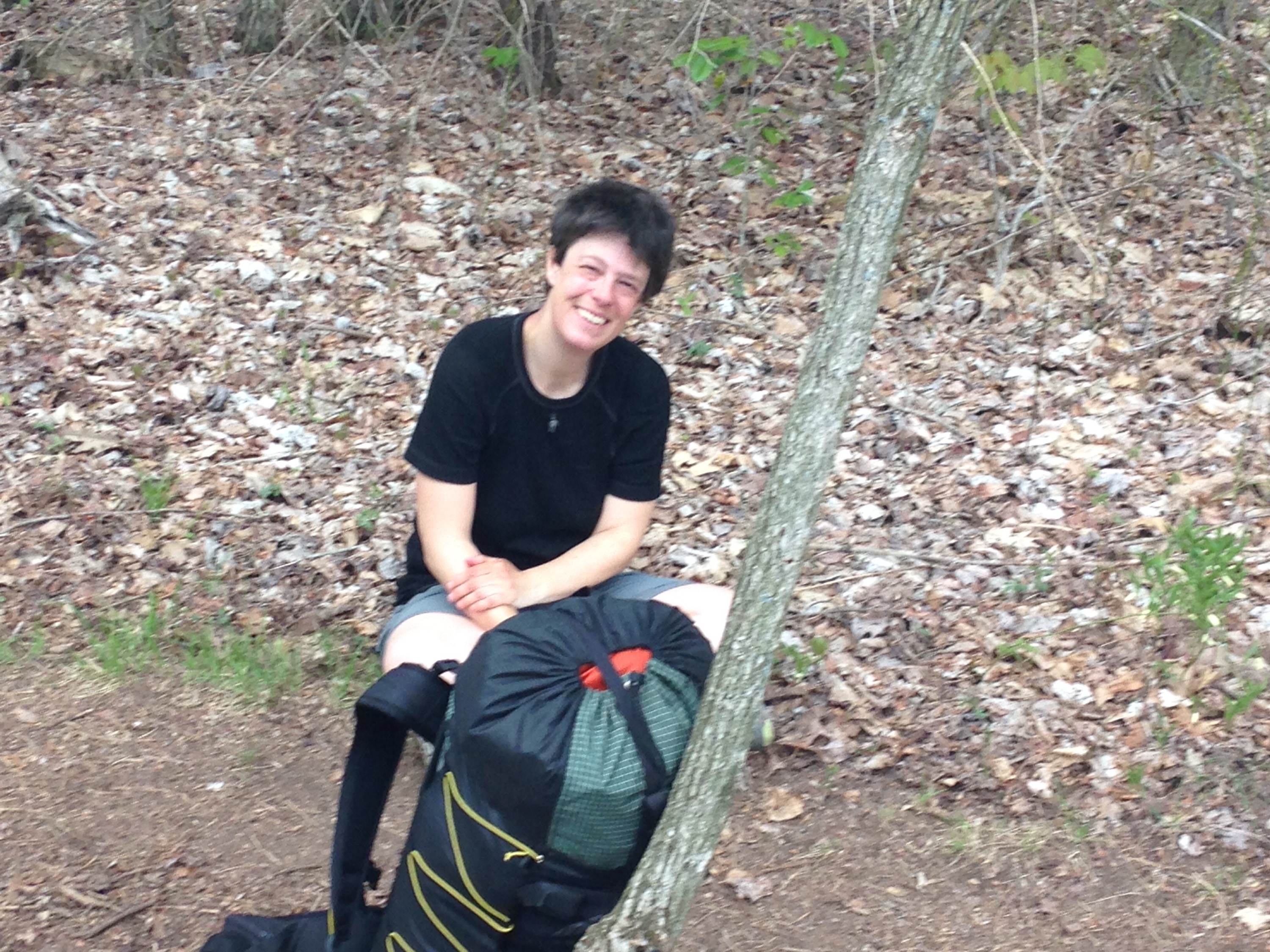
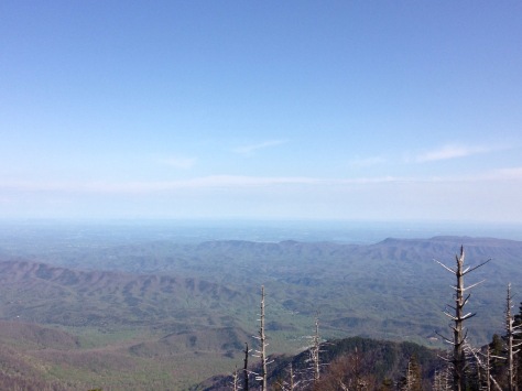
Mile 343 (352), km 569. Had some nice and sunny days, only little rain on Sunday. Seen some ‘old-style’ local country shops which are really worth remembering. Still much to cold for this time of the tear, temperature go down to 0 C nighttime in the mountains. Great views from Big Bald summit (pictures). Tomorrow will be our third zero day in Erwin, TN – some work has to be done, really hope the Wifi at our motel will work so I can do Skype calls. Biggest problem at the moment are my achilles tendons – they really hurt badly. I used to this since I had to end my (ultra)running career 1999 due to a chronical inflammation but had not expected that hiking would cause such problems. Great that you get ice everywhere in the US – will take 3-4 ice trearments until we continue our hike Thursday morning.
Now we have done 274 (283) miles. Who can say that he/she has walked 453 km in 3 weeks in our modern society? Still it’s only just 1/8 of the entire Appalachian Trail. Tool an additional unplanned Zero day in Gatlinburg, Tennessee because Silva’s got a cold after seceral days in the pouring rain. Seen our first (wild) bears! 4 in the morning after starting from Standing Bear (!) hostel. Some 50 meters above us on a steep slope and after the next switchback one was standing directly on the trail. Exciting! Did our first 20 miles (32 km) day and had our coldest night so far (around 0 Celsius, hard wind from the west) on Walnut Mountain. A lot of sun and no rain the last 4 days but really cold wind.
Busted flat in Gatlinburg, waitin’ for the rain to end, feelin near as faded as … don’t know what, hikers wear no jeans (see K. Kristofferson). After the last few days I would rather call the Great Smokey Mountains the Great Muddy Mountains and the trail ‘Appalachian channel’. Guys we met said they have not seen the trail that muddy for the last 30 years. No day without rain for more than 10 days and the descent from Clingmans Dome today was just walking in a stream. Clingmans Dome is besides the highest point of the A.T., 2025m. In pouring rain and hard winds we had no real joy to celebrate this moment. No down to Gatlinburg which is known as the USA’s most touristic town (the Great Smokey Mountains NP is the USA’s most visited National Park). The whole town feels a little bit like the Vienna Prater, of course US style. Dunkin Donuts is next to our Motel and I’m wondering if I should check out what it is that attracts Homer Simpson that much. I guess we’ll take our second zero day tomorrow if it continues to rain that heavily. Wait and see what tomorrow brings!
166 (175) miles / 280 km done. About 1/13 of the trail 😄. No pain, no rain – no Maine many people say. We had A LOT of rain the last few days and the trail was deep and VERY muddy. Some times really hard to do the steep climbs and descents without falling.
The song for the last days of pouring rain: http://youtu.be/a30R_drH2GA – even if we enter the Smokies first on Friday.
The 950 m climb from Nantahala Outdoor Center to Cheohah Bald was the 7th hardest of the entire AT and a guy who needed 3 days for this section said it’s the longest continous ascent of the whole trail.
The trail name issue seems to become more and more urgent. Until now we avoided to take trail names – just used our ‘normal’ ones, but as a lot of hikers already quit and dropped off for the ones still on the trail a trail name is a ‘must have’. Silva thinks Silva is perfect even as trail name as it’s Latin for ‘wood’. Im tending to eventually take ‘Spock’, honouring actor and wise man Leonhard Nimoy.
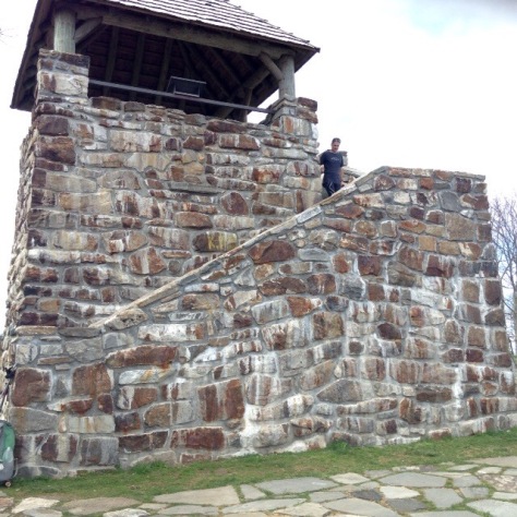
110 miles (+9 with Approach Tr) in total. A half zero say for resupply and gear issues in Franklin, North Carolina. New trail shoes for Silva and a better rope for hanging our food bags – not all shelters have bear cables we learned. Yesterday we crossed the first state line (Georgia – North Carolina, yeah!), then a really hard and steep climb to Mt Albert fire tower (pictures!). Followed by an evening with heavy showers and a cold night at Long Branch Shelter. Some hours of chilling in sunny and warm (25 C) Franklin. Next planned stop is Nantahala OC, then 2 more days to the Southern entrance of the Great Smoky Mountains NP where the highest summit of the entire AT – Clingman Dome – waits.
The first 6 days on the AT are done, 69,6 miles + 8,8 miles Approach Trail. Experienced most what you expect from a Thru Hilke: Temperatures below 0 (Celsius) the first night, sun-burned our necks the second day, heavy rainfall and pitching our tent in deep mud (Mud can make you prisoner and the plains can bake you dry, snow can burn your eyes but only people make you cry – Lee Marvin, Wandrin’ Star) on day 4, an unplanned town-stop in picturesque Bavarian-style Helen, Georgia on day 5 for getting out gear dry again and a lot of sun with temperatures up to 27 C on day 6. Add some gear problems as a dirt water bottle that did not fit together with the filter or ultralight tent pegs that did not work and you get a perfect Thru Hike start! More to come, we keep on hiking!
We arrived at Jackson Hartfield, airport, Atlanta after an almost 24 hours trip from North Sweden, staying for 2 nights at a hotel nearby the airport before taking MARTA to North Springs and Survivor Dave’s trail shuttle to Amicalola SP on Friday. Thursday is dedicated to some hours of rest, a good dinner and food supply for the first 4 hiking days. What you can see on the picture is – for the 2 of us – 7,6 kg of food which should offer approx. 28 000 kcal.
Less than one week before starting the big adventure – completing an Appalachian Trail Thru Hike. Here at the Arctic Circle in Northern Sweden there is still a lot of snow and my training focus is cross-country skiing until the last day.
Wolfgang & Silva`s Appalachian Trail thru hike 2015


![IMG_0942[1]](https://wolfgangsat2015.files.wordpress.com/2015/03/img_09421.jpg)
![IMG_0943[1]](https://wolfgangsat2015.files.wordpress.com/2015/03/img_09431.jpg)
![IMG_0941[1]](https://wolfgangsat2015.files.wordpress.com/2015/03/img_09411.jpg)
![IMG_0947[1]](https://wolfgangsat2015.files.wordpress.com/2015/03/img_09471.jpg)
